
El Cajon ZIP Codes by Postal Territory
Five ZIP codes appear in El Cajon research, but they do not all describe ordinary street-address neighborhoods. The three principal street ZIPs are 92019, 92020, and 92021. Two other codes appear in local administrative or court-routing material and need a recipient-level check. The table keeps the postal question separate from the city question, which is the key to a reliable ZIP code directory.
| ZIP | Areas Covered | Post Office | Notes |
|---|---|---|---|
| 92019 | Southern and eastern El Cajon; nearby Rancho San Diego and Dehesa postal territory | Verify through USPS address lookup | Can include addresses outside incorporated El Cajon |
| 92020 | Western and central El Cajon, including downtown and Fletcher Hills vicinity | Verify through USPS address lookup | Postal geography does not settle every local boundary question |
| 92021 | Northern and eastern El Cajon, including Bostonia vicinity | Verify through USPS address lookup | A substantial part of the postal area may be unincorporated county |
| 92022 | PO-box or administrative use reported in local documents | Verify the exact recipient and box | Not a normal substitute for a street-address ZIP |
| 92090 | Special or PO-box routing in court-filing material | Verify the exact mailing record | Not evidence of an ordinary El Cajon residential area |
A ZIP code directory can describe a route, but it cannot enumerate the people on that route. USPS controls the mailing ZIP. City and county GIS control incorporated status and parcel jurisdiction. The same street may therefore have a postal label that reaches beyond El Cajon, while an administrative ZIP says little about a physical block.
El Cajon 92019 ZIP Territory Beyond the City Line
ZIP code 92019 is the clearest boundary trap in the El Cajon area. It serves southern and eastern parts of the city, but it also reaches nearby Rancho San Diego and Dehesa postal territory. Rancho San Diego is a separate unincorporated community even when the mailing city says El Cajon. A 92019 result therefore answers a mail-routing question first, not a city-limit question.
For a person or address tied to 92019, write down the full street address, city, state, and unit if any. Then compare the city boundary and parcel layers in the El Cajon GIS Hub. If the parcel is outside the incorporated city, a city permit or city records request may be the wrong channel. County systems may hold the assessment, deed, or permit evidence instead.
This is a useful quirk rather than an error. Postal areas are built for delivery efficiency. Municipal records are built for jurisdiction. A postal directory that states both facts gives a better lead than one that assigns every 92019 record to the city.
El Cajon 92020 ZIP: West and Central Ground
The 92020 route is associated with western and central El Cajon, including the downtown and Fletcher Hills vicinity. It is a useful first sort for a known street, but it does not replace the parcel map. A mailing label can group nearby addresses that sit under different planning, zoning, council-district, or county responsibilities.
Use the postal code as a way to narrow a research list, then move to the exact address. The assessor’s secured-roll search accepts a street number and street name or an APN, not a public ZIP-wide resident export. The online result can show APN, situs, lien date, assessed land and improvement values, exemptions, and change notices. Owner names are withheld online under California law; ARCC provides ownership and address information through a phone or kiosk channel.
That sequence matters for any El Cajon postal-directory work. A 92020 name or address can be a good lead, while the parcel and custodian decide what record can be sought next.
El Cajon 92021 ZIP and the Bostonia Boundary
The 92021 route reaches northern and eastern El Cajon and the Bostonia vicinity. Bostonia carries its own history: part of the former Boston Ranch area was annexed in the 1950s, while the remainder stayed unincorporated. Interstate 8, completed through the area in the 1960s, also split older city and Bostonia patterns. A directory entry, census label, or postal line from this corridor needs a period map and a parcel check.
A 92021 search should preserve the date of the source. Historic directories can use valley, township, subdivision, or community labels before later city terms settle in. The ZIP itself is not a historical boundary marker, and no official ZIP split or realignment year was located for the area. Avoid assigning a past address to today’s city line without evidence from the period.
Note: Bostonia’s postal geography can reach beyond city limits, so a ZIP match should lead to a map check rather than end the search.
El Cajon 92022 and 92090 Special ZIP Routing
92022 appears in local documents as a PO-box or administrative code. ZIP code 92090 appears in broader postal or court-filing references as a special or PO-box route. Neither should be treated as an ordinary neighborhood label. A listing with one of these codes needs the recipient, box, or filing context before it can be mapped.
The practical check is simple: run the complete address or mailing line through USPS, then ask what kind of location the result represents. A PO-box ZIP can route correspondence without locating a residence. A court filing code can identify a service route without describing where a party lives. Keep the code in the record, but do not turn it into a city or block claim.
El Cajon ZIP Lines and City Limits
The El Cajon GIS Hub includes city boundaries, ZIPs, parcels, zoning, council districts, and project layers. Open the ZIP and boundary layers together. A map click can supply parcel context and an APN, but the map does not establish title, occupancy, or a complete resident list. Save the layer names, legend, and date when the boundary affects a request.
USPS and GIS serve different roles. USPS decides the mailing ZIP for a submitted address. GIS shows the local geography used for jurisdiction. When the two disagree, use USPS for the label and county or city GIS for the office that holds a parcel or permit. The San Diego County jurisdiction guidance is a useful boundary check when an El Cajon mailing address may fall outside the incorporated city. This is especially important in 92019 and 92021, where nearby unincorporated territory can use El Cajon mailing language.
- ZIP code
- A five-digit postal routing area used to sort mail. It is not a city boundary.
- ZIP+4
- A four-digit extension that narrows delivery to a segment, building, floor, or box range.
- PO-box ZIP
- A code used for a box or administrative route rather than a normal street residence.
- Unique ZIP
- A code assigned to one organization or special destination rather than a broad neighborhood.
- Carrier route
- A delivery path within a postal area. It is a mail-work unit, not a public household roll.
USPS ZIP Fields for One El Cajon Address
The safest ZIP code directory result is tied to one complete address. The USPS address lookup takes a street address, city, state, and unit when applicable. Enter the street number and street name as written, then test a unit separately if the first result fails. A result may normalize the city line or return the ZIP+4, so save the input and returned form together.
| Street address | House number and street name; use the full civic line rather than a landmark. |
|---|---|
| City | The mailing city supplied with the address; it does not prove incorporated status. |
| State | Use California when checking an El Cajon area address. |
| Unit | Add an apartment, suite, or box unit when the address requires one. |
| Returned ZIP | Use the returned five-digit or ZIP+4 result for mail routing, then compare the parcel map. |
The USPS ZIP Code Lookup image shows the address-first form that should anchor a ZIP check. It is more precise than copying a ZIP from a people list or an old document.
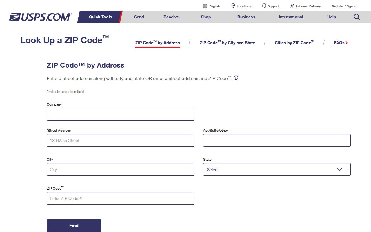
The returned route is a mail answer. Use the El Cajon GIS Hub or county parcel tools for city status, APN, zoning, and nearby boundaries.
Finding El Cajon Residents by ZIP
A ZIP code directory cannot supply a verified public list of every resident in 92019, 92020, or 92021. The San Diego County assessor search is address or APN based. The GIS Hub maps parcels and layers. California My Voter Status requires personal authentication, and voter files require a qualifying purpose under Elections Code section 2194 and 2 CCR sections 19001-19013. Aggregated Census or election data can describe a ZIP, but it does not enumerate people.
- Verify the complete street address, city, state, unit, and returned ZIP through USPS.
- Overlay that ZIP with the city boundary and parcel layer in the El Cajon GIS Hub.
- Use the San Diego assessment search by address or APN for parcel and value context.
- Choose the lawful custodian for the next question, such as a deed, permit, court file, or historical directory.
- For a narrowed street, use the El Cajon street directory workflow rather than treating the ZIP as the search key.
If an address is outside the incorporated city, shift the request to the county office that holds the record. If the question is about a person rather than a parcel, a ZIP is only one disambiguating fact. Add a name, date, or address and confirm the result with the source custodian.
El Cajon ZIP Results and Jurisdiction Checks
An APN is a tax identifier, not a ZIP code, street address, or legal description. A situs address locates the parcel and improvement. A tax mailing address routes correspondence and may point elsewhere. A legal description ties a deed to a subdivision lot, block, or other land description. Those three labels can diverge while the USPS result remains correct.
When a ZIP result conflicts with a city label, keep both records and state the question each one answers. Use USPS for delivery. Use city or county GIS for jurisdiction. Use ARCC for assessment and deed channels. Use a library or archive for an old directory. There is no official neighborhood narrative or simple historical ZIP split table to fill the gap, so a precise address check is more honest than a neat but unsupported map.
The ZIP code directory is most useful as a routing aid. It narrows a search, flags a boundary issue, and points to the next record keeper. It does not prove that a person lives in a city, owns a parcel, belongs to a block, or appears in every address record.